Clock tower and tennis courts, Clockhouse Lane Park
Introduction
The photograph on this page of Clock tower and tennis courts, Clockhouse Lane Park by Robin Webster as part of the Geograph project.
The Geograph project started in 2005 with the aim of publishing, organising and preserving representative images for every square kilometre of Great Britain, Ireland and the Isle of Man.

There are currently over 7.5m images from over 14,400 individuals and you can help contribute to the project by visiting https://www.geograph.org.uk
Clock tower and tennis courts, Clockhouse Lane Park
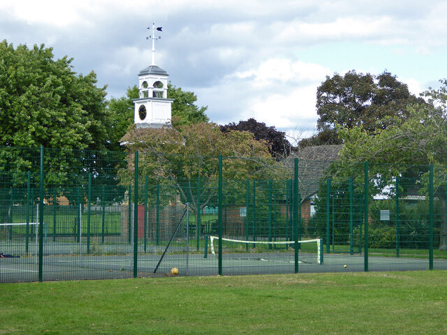
Image: © Robin Webster Taken: 12 Aug 2017
A surprising feature of a small park and recreation ground. A 1962 photograph reveals that this is the remaining core of an octagonal shelter or pavilion. Clockhouse Lane is named after Clock House, that was on the other side of the road, but now demolished. Was the clock, assuming there was one, transferred here?
Images are licensed for reuse under creativecommons.org/licenses/by-sa/2.0
Image Location
Latitude
51.434368
Longitude
-0.4539