Waldon valley near Dinworthy
Introduction
The photograph on this page of Waldon valley near Dinworthy by Derek Harper as part of the Geograph project.
The Geograph project started in 2005 with the aim of publishing, organising and preserving representative images for every square kilometre of Great Britain, Ireland and the Isle of Man.

There are currently over 7.5m images from over 14,400 individuals and you can help contribute to the project by visiting https://www.geograph.org.uk
Waldon valley near Dinworthy
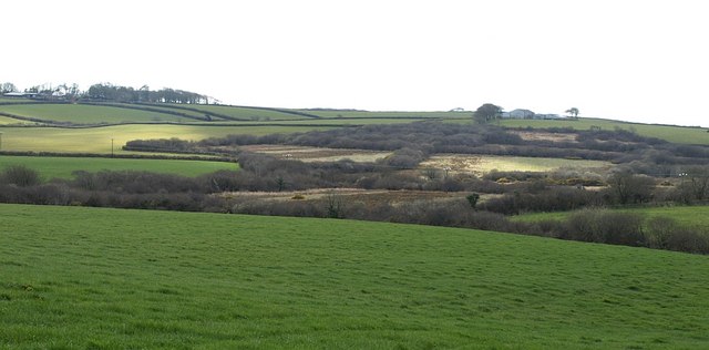
Image: © Derek Harper Taken: 27 Mar 2008
A gentle section of the higher Waldon valley; the river rises only about a kilometre away. Old field boundaries lined with bushes and small trees divide the area around the stream into small compartments. On the left on the hilltop is the northern edge of the woodland around West Down also seen from the other direction in Image This view is taken from a marshy overgrown track that used to be the line of Bradworthy Footpath 11, now slightly diverted through a neighbouring field.
Images are licensed for reuse under creativecommons.org/licenses/by-sa/2.0
Image Location
Latitude
50.910327
Longitude
-4.416646