Viaduct Estate Road
Introduction
The photograph on this page of Viaduct Estate Road by Adrian Taylor as part of the Geograph project.
The Geograph project started in 2005 with the aim of publishing, organising and preserving representative images for every square kilometre of Great Britain, Ireland and the Isle of Man.

There are currently over 7.5m images from over 14,400 individuals and you can help contribute to the project by visiting https://www.geograph.org.uk
Viaduct Estate Road
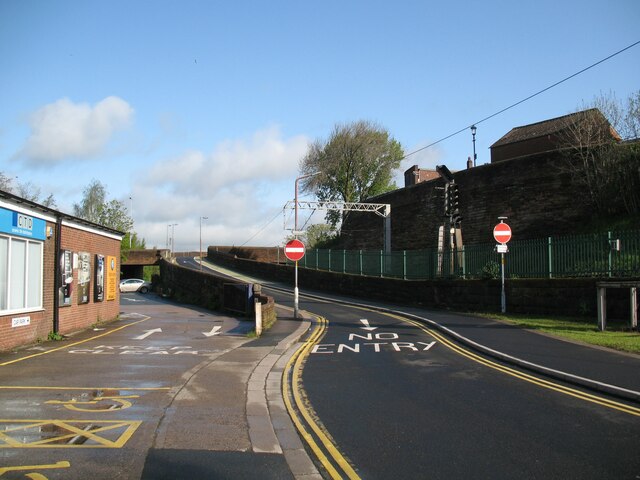
Image: © Adrian Taylor Taken: 11 May 2015
This part of the Viaduct Estate Road is the route of The Cumbria Way, leading up the ramp beside the West Coast Main Line railway (next photograph Image). The bridge in the left background was provided for the Carlisle Goods Lines and railway tracks leading into the Viaduct Goods Yard. Some commercial premises still remain on the Viaduct Estate, but it is beside the River Caldew and has been subjected to several flooding events; consequently much of the former railway goods yard is now used for car parking.
Images are licensed for reuse under creativecommons.org/licenses/by-sa/2.0
Image Location
Latitude
54.894652
Longitude
-2.942218