Marsh Lane Narrows near Fordhouses in Wolverhampton
Introduction
The photograph on this page of Marsh Lane Narrows near Fordhouses in Wolverhampton by Roger Kidd as part of the Geograph project.
The Geograph project started in 2005 with the aim of publishing, organising and preserving representative images for every square kilometre of Great Britain, Ireland and the Isle of Man.

There are currently over 7.5m images from over 14,400 individuals and you can help contribute to the project by visiting https://www.geograph.org.uk
Marsh Lane Narrows near Fordhouses in Wolverhampton
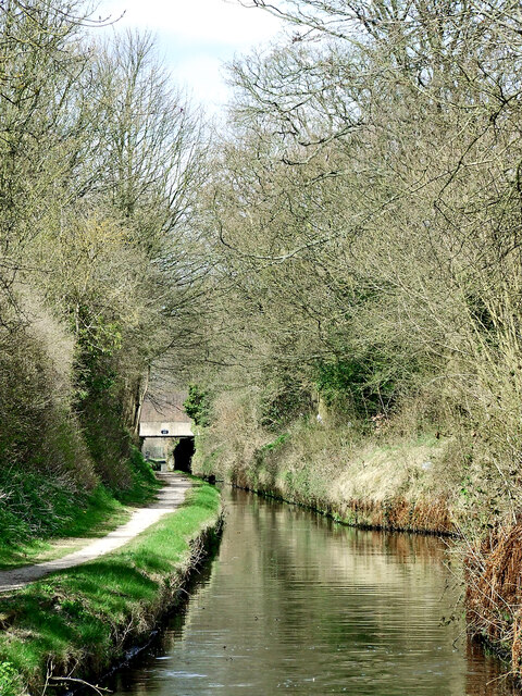
Image: © Roger Kidd Taken: 19 Apr 2013
Looking north-north-east towards Forster Bridge (No 68), this is a narrow part of the Staffordshire and Worcestershire Canal cut into the local Triassic sandstone. It is sometimes referred to as Autherley Narrows. The boatmen called it Pendeford Rockin' after a local farm. The only likely one I can find on Victorian maps is Pendeford Farm (Now Upper Pendeford Farm) about a kilometre (just over half a mile) to the west (left). Narrowboats cannot pass each other for six hundred metres except at two small tight passing places. One can be seen on the right in this image. A seventy feet long boat can squash into it while another passes, probably scraping on both sides! When the trees are full of foliage, this can be a very gloomy and damp length of canal.
Images are licensed for reuse under creativecommons.org/licenses/by-sa/2.0
Image Location
Latitude
52.628547
Longitude
-2.137945