Enclosed spring / well in woodland
Introduction
The photograph on this page of Enclosed spring / well in woodland by David Robinson as part of the Geograph project.
The Geograph project started in 2005 with the aim of publishing, organising and preserving representative images for every square kilometre of Great Britain, Ireland and the Isle of Man.

There are currently over 7.5m images from over 14,400 individuals and you can help contribute to the project by visiting https://www.geograph.org.uk
Enclosed spring / well in woodland
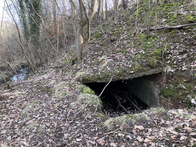
Image: © David Robinson Taken: 8 Feb 2023
Located where old maps show a spring, it appears that the flow has been managed / contained, perhaps due to the proximity to a mill race at the time of construction. The mill, mill race, mineral railway and adjacent quarried area have all returned to nature, but this rather eerie water filled bunker remains hidden in the woodland.
Images are licensed for reuse under creativecommons.org/licenses/by-sa/2.0
Image Location
Latitude
54.711972
Longitude
-1.483885