North Street, Stoke, Coventry
Introduction
The photograph on this page of North Street, Stoke, Coventry by A J Paxton as part of the Geograph project.
The Geograph project started in 2005 with the aim of publishing, organising and preserving representative images for every square kilometre of Great Britain, Ireland and the Isle of Man.

There are currently over 7.5m images from over 14,400 individuals and you can help contribute to the project by visiting https://www.geograph.org.uk
North Street, Stoke, Coventry
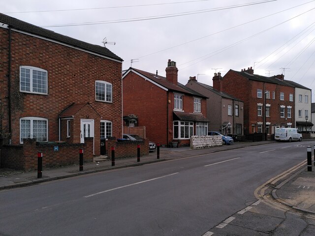
Image: © A J Paxton Taken: 12 Feb 2023
North Street forms part of Upper Stoke, a block of streets to the east of Barras Heath that seems to have been built up piecemeal in the 19th century with a great variety of house types. The row of six three-storey houses to the right are unmistakeably ribbon-weavers' houses with their high top-shops on the topmost floor for the tall jacquard looms. The outlines of the large windows, now partly filled in with bricks of a different colour and texture, can clearly be seen, except on the pair of houses that have been rendered. The pair of houses on the left has the red and yellow chequerboard brickwork that is very common in parts of Warwickshire.
Images are licensed for reuse under creativecommons.org/licenses/by-sa/2.0
Image Location
Latitude
52.418005
Longitude
-1.476365