View at Abbey Bridge
Introduction
The photograph on this page of View at Abbey Bridge by Kenneth Allen as part of the Geograph project.
The Geograph project started in 2005 with the aim of publishing, organising and preserving representative images for every square kilometre of Great Britain, Ireland and the Isle of Man.

There are currently over 7.5m images from over 14,400 individuals and you can help contribute to the project by visiting https://www.geograph.org.uk
View at Abbey Bridge
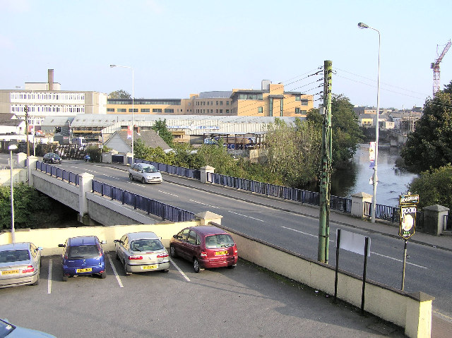
Image: © Kenneth Allen Taken: 15 Oct 2005
The bridge spans the Strule river as it flows northwards from Omagh. The view is looking towards the south east. In the background is the new College of Further Education. To the left is Strule House,(c.1970) shortly to be demolished and it was part of the old college complex. It was one of the ugliest buildings to be erected in Omagh. The old model primary school was on this site and is long gone.
Images are licensed for reuse under creativecommons.org/licenses/by-sa/2.0
Image Location


Leaflet Map data © OpenStreetMap
Latitude
54.600557
Longitude
-7.307572