Boundary Stone, Lea Bailey
Introduction
The photograph on this page of Boundary Stone, Lea Bailey by Mr Red as part of the Geograph project.
The Geograph project started in 2005 with the aim of publishing, organising and preserving representative images for every square kilometre of Great Britain, Ireland and the Isle of Man.

There are currently over 7.5m images from over 14,400 individuals and you can help contribute to the project by visiting https://www.geograph.org.uk
Boundary Stone, Lea Bailey
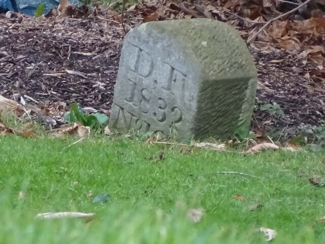
Image: © Mr Red Taken: 26 Jan 2023
Visible from the entrance gate, on private land. Marking the boundary of the Royal Forest of Dean, traditionally all in Gloucestershire, but now small tracts are in Herefordshire. Inscription: D. F / 1832 / Nᴼ. 167 Milestone Society National ID: HF_DFWEST167em
Images are licensed for reuse under creativecommons.org/licenses/by-sa/2.0
Image Location


Leaflet Map data © OpenStreetMap
Latitude
51.882889
Longitude
-2.512292