"The Loop", Conningbrook Avenue, Ashford
Introduction
The photograph on this page of "The Loop", Conningbrook Avenue, Ashford by pam fray as part of the Geograph project.
The Geograph project started in 2005 with the aim of publishing, organising and preserving representative images for every square kilometre of Great Britain, Ireland and the Isle of Man.

There are currently over 7.5m images from over 14,400 individuals and you can help contribute to the project by visiting https://www.geograph.org.uk
"The Loop", Conningbrook Avenue, Ashford
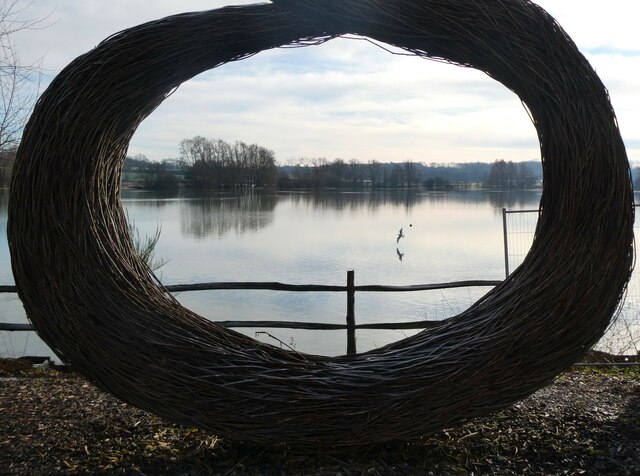
Image: © pam fray Taken: 17 Jan 2023
A willow sculpture by artist Julia Clarke next to Conningwood Lakes Country Park. This former gravel and sand extraction pit has been transformed into a series of three lakes – the Main lake, Eco lake and Northern lake. These lakes are encompassed by wet woodland, ponds, reedbeds and grasslands. Kent Wildlife Trust are managing over half of the site on behalf of Ashford Borough Council, with Ashford Leisure Trust and Mid Kent Fisheries also working in partnership.
Images are licensed for reuse under creativecommons.org/licenses/by-sa/2.0
Image Location
Latitude
51.156591
Longitude
0.902858