Flood defences by Town House Road
Introduction
The photograph on this page of Flood defences by Town House Road by Kevin Waterhouse as part of the Geograph project.
The Geograph project started in 2005 with the aim of publishing, organising and preserving representative images for every square kilometre of Great Britain, Ireland and the Isle of Man.

There are currently over 7.5m images from over 14,400 individuals and you can help contribute to the project by visiting https://www.geograph.org.uk
Flood defences by Town House Road
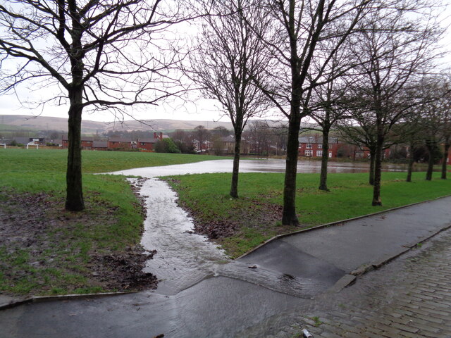
Image: © Kevin Waterhouse Taken: 26 Dec 2015
The Environment Agency had commissioned this playing field area to be hollowed out to back fill with water from culverts overflowing where they discharge into the River Roch. In this view water flowing down Town House Road is also entering the lagoon during the Boxing Day floods of 2015.
Images are licensed for reuse under creativecommons.org/licenses/by-sa/2.0
Image Location
Latitude
53.646678
Longitude
-2.095416