Harmby upper waterfall
Introduction
The photograph on this page of Harmby upper waterfall by Gordon Hatton as part of the Geograph project.
The Geograph project started in 2005 with the aim of publishing, organising and preserving representative images for every square kilometre of Great Britain, Ireland and the Isle of Man.

There are currently over 7.5m images from over 14,400 individuals and you can help contribute to the project by visiting https://www.geograph.org.uk
Harmby upper waterfall
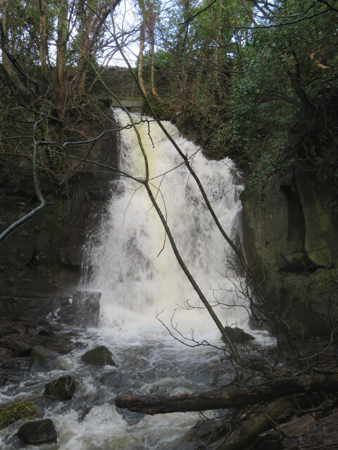
Image: © Gordon Hatton Taken: 12 Jan 2023
It's several years since I last submitted a photo of this waterfall, but on this occasion the small beck that feeds it was running very high after recent rains. Few people ever realise that this waterfall exists although the wall that can just be seen above the fall is at the edge of the A684, whilst on the far side of that road is the Pheasant Inn
Images are licensed for reuse under creativecommons.org/licenses/by-sa/2.0
Image Location
Latitude
54.304458
Longitude
-1.804798