The Bull, Long Melford
Introduction
The photograph on this page of The Bull, Long Melford by Richard Rogerson as part of the Geograph project.
The Geograph project started in 2005 with the aim of publishing, organising and preserving representative images for every square kilometre of Great Britain, Ireland and the Isle of Man.

There are currently over 7.5m images from over 14,400 individuals and you can help contribute to the project by visiting https://www.geograph.org.uk
The Bull, Long Melford
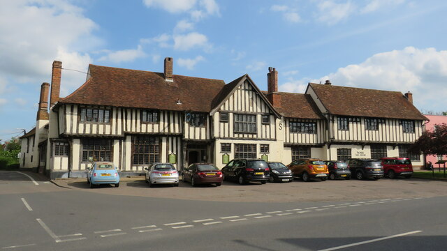
Image: © Richard Rogerson Taken: 5 May 2022
The hotel website claims that The Bull was built in 1450 and became an inn in 1570, https://www.greenekinginns.co.uk/hotels/bull-hotel-melford albeit its Historic England listing says it is ‘known to have been an inn under the same name since at least 1580 when it was marked on a manor map of that date.’ https://historicengland.org.uk/listing/the-list/list-entry/1182781?section=official-list-entry
Images are licensed for reuse under creativecommons.org/licenses/by-sa/2.0
Image Location
Latitude
52.079602
Longitude
0.719659