Hearsall Lane
Introduction
The photograph on this page of Hearsall Lane by E Gammie as part of the Geograph project.
The Geograph project started in 2005 with the aim of publishing, organising and preserving representative images for every square kilometre of Great Britain, Ireland and the Isle of Man.

There are currently over 7.5m images from over 14,400 individuals and you can help contribute to the project by visiting https://www.geograph.org.uk
Hearsall Lane
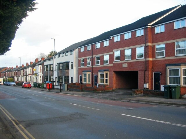
Image: © E Gammie Taken: 9 Jan 2023
Most of the housing on Hearsall Lane was constructed in the early years of the 20th century. In contrast, the buildings in the foreground were constructed almost 100 years later. The nearer building, Wells Terrace, was built in a long-standing gap in 2011/12 and the neighbouring grey and white building constructed on the site of a former industrial photographer's building seen here in 2016: Image
Images are licensed for reuse under creativecommons.org/licenses/by-sa/2.0
Image Location
Latitude
52.406818
Longitude
-1.531327