Dougalston Loch
Introduction
The photograph on this page of Dougalston Loch by Richard Sutcliffe as part of the Geograph project.
The Geograph project started in 2005 with the aim of publishing, organising and preserving representative images for every square kilometre of Great Britain, Ireland and the Isle of Man.

There are currently over 7.5m images from over 14,400 individuals and you can help contribute to the project by visiting https://www.geograph.org.uk
Dougalston Loch
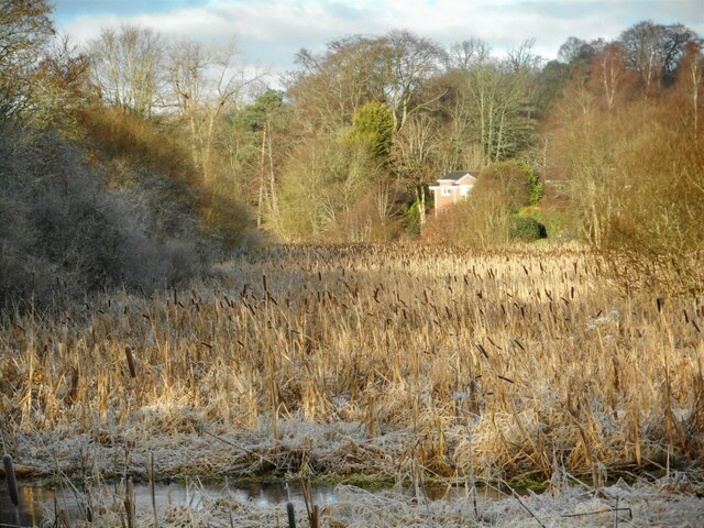
Image: © Richard Sutcliffe Taken: 2 Jan 2023
The much silted-up southeastern end of Dougalston Loch, much of which is full of greater reedmace (Typha latifolia). The Craigmaddie Burn is in the immediate foreground. Seen on a cold and frosty January morning. The loch and part of Dougalston Estate are designated as a Local Nature Conservation Site by East Dunbartonshire Council.
Images are licensed for reuse under creativecommons.org/licenses/by-sa/2.0
Image Location
Latitude
55.934785
Longitude
-4.30354