Footpath for a lost railway
Introduction
The photograph on this page of Footpath for a lost railway by Neil Owen as part of the Geograph project.
The Geograph project started in 2005 with the aim of publishing, organising and preserving representative images for every square kilometre of Great Britain, Ireland and the Isle of Man.

There are currently over 7.5m images from over 14,400 individuals and you can help contribute to the project by visiting https://www.geograph.org.uk
Footpath for a lost railway
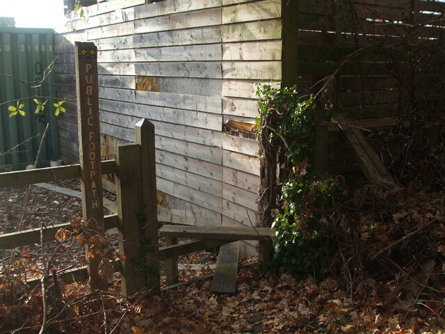
Image: © Neil Owen Taken: 14 Dec 2022
A footpath still makes its way over a stile and across the industrial estate. In the past, the path crossed the old railway lines; the tracks are gone and are now replaced by the A371 East Somerset Way. Sadly, the signpost has fallen behind the wooden shed.
Images are licensed for reuse under creativecommons.org/licenses/by-sa/2.0
Image Location


Leaflet Map data © OpenStreetMap
Latitude
51.20287
Longitude
-2.647199