Woodhouse Eaves Windmill viewing platform
Introduction
The photograph on this page of Woodhouse Eaves Windmill viewing platform by Ian Calderwood as part of the Geograph project.
The Geograph project started in 2005 with the aim of publishing, organising and preserving representative images for every square kilometre of Great Britain, Ireland and the Isle of Man.

There are currently over 7.5m images from over 14,400 individuals and you can help contribute to the project by visiting https://www.geograph.org.uk
Woodhouse Eaves Windmill viewing platform
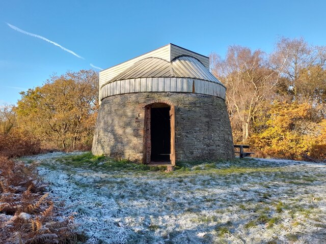
Image: © Ian Calderwood Taken: 10 Dec 2022
The windmill at Woodhouse Eaves was built in the early 1800s and operated until 1895. The viewing platform mimics the shape of the lowest few feet of the original wooden structure, which burnt down in the 1940s. It is accessed by a staircase inside the original stone base.
Images are licensed for reuse under creativecommons.org/licenses/by-sa/2.0
Image Location
Latitude
52.723707
Longitude
-1.222338