Chepstow features [14]
Introduction
The photograph on this page of Chepstow features [14] by Michael Dibb as part of the Geograph project.
The Geograph project started in 2005 with the aim of publishing, organising and preserving representative images for every square kilometre of Great Britain, Ireland and the Isle of Man.

There are currently over 7.5m images from over 14,400 individuals and you can help contribute to the project by visiting https://www.geograph.org.uk
Chepstow features [14]
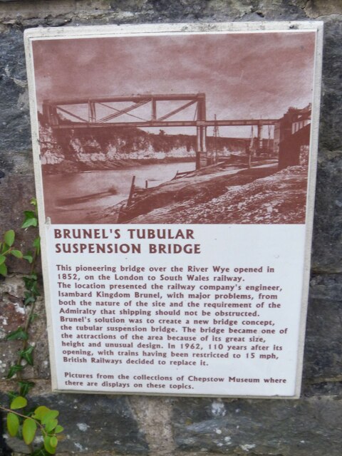
Image: © Michael Dibb Taken: 3 Sep 2022
An information board about the tubular suspension bridge that once carried the railway over the River Wye. Much of the superstructure was replaced in 1962 by an underhung truss, but Brunel's cast iron pillars for the original bridge, still support the modern bridge. The bridge is listed, grade II, with details at: https://historicengland.org.uk/listing/the-list/list-entry/1186666 Chepstow, the most easterly town in Wales, is located on the tidal River Wye, some 3 miles above its confluence with the River Severn. There is evidence of continuous human occupation from the Mesolithic period. The town grew in importance when the Normans erected a castle at what was the lowest bridging point of the River Wye. The town flourished as a port, being exempt from English taxation, and it mainly traded in timber and bark from the Wye Valley. The town became an important centre for tourism from the late eighteenth century.
Images are licensed for reuse under creativecommons.org/licenses/by-sa/2.0
Image Location
Latitude
51.64451
Longitude
-2.668934