Aberaeron Union Workhouse/Cottage Hospital
Introduction
The photograph on this page of Aberaeron Union Workhouse/Cottage Hospital by N Scott as part of the Geograph project.
The Geograph project started in 2005 with the aim of publishing, organising and preserving representative images for every square kilometre of Great Britain, Ireland and the Isle of Man.

There are currently over 7.5m images from over 14,400 individuals and you can help contribute to the project by visiting https://www.geograph.org.uk
Aberaeron Union Workhouse/Cottage Hospital
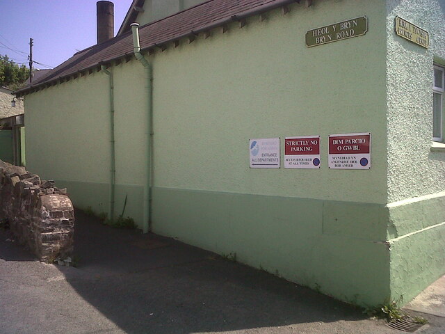
Image: © N Scott Taken: 17 Jul 2013
This face of the building bore OSBM flush bracket S0449 at the East (left) angle: The bracket was used on the Aberystwyth to Lampeter secondary line of the Second Geodetic Levelling of England & Wales in 1942. It was levelled with a height of 43.956' above OD (Newlyn). Description: E angle of workhouse, Aberayron. Abstract A 483: http://discovery.nationalarchives.gov.uk/details/r/C11178827 [OS 54/148] The bracket, which had been obscured by rendering, was replaced by G2986 on the Midland Bank for the Third Geodetic Levelling in 1956. Front: Image
Images are licensed for reuse under creativecommons.org/licenses/by-sa/2.0
Image Location
Latitude
52.243522
Longitude
-4.255246