Watford Fire Station
Introduction
The photograph on this page of Watford Fire Station by Nigel Cox as part of the Geograph project.
The Geograph project started in 2005 with the aim of publishing, organising and preserving representative images for every square kilometre of Great Britain, Ireland and the Isle of Man.

There are currently over 7.5m images from over 14,400 individuals and you can help contribute to the project by visiting https://www.geograph.org.uk
Watford Fire Station
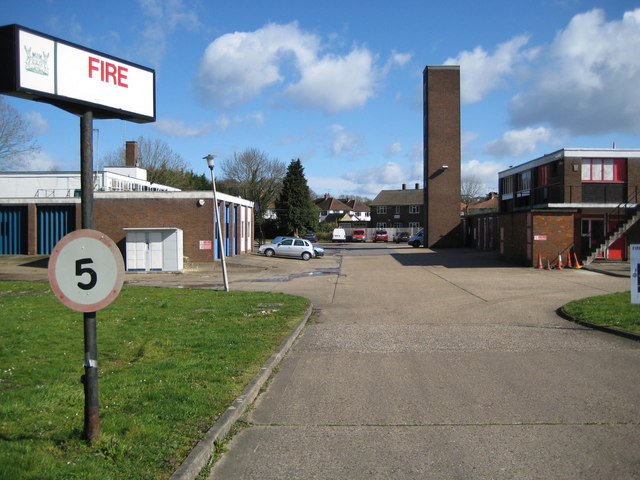
Image: © Nigel Cox Taken: 21 Mar 2008
This is the Whippendell Road entrance to the fire station with the drill tower to the right. Kevin's Image was taken from around the corner to the left in Rickmansworth Road. The site is being considered for redevelopment with a new fire station being built elsewhere nearer the centre of the town.
Images are licensed for reuse under creativecommons.org/licenses/by-sa/2.0
Image Location


Leaflet Map data © OpenStreetMap
Latitude
51.652234
Longitude
-0.425827