The rear of 16 West High Street
Introduction
The photograph on this page of The rear of 16 West High Street by Richard Sutcliffe as part of the Geograph project.
The Geograph project started in 2005 with the aim of publishing, organising and preserving representative images for every square kilometre of Great Britain, Ireland and the Isle of Man.

There are currently over 7.5m images from over 14,400 individuals and you can help contribute to the project by visiting https://www.geograph.org.uk
The rear of 16 West High Street
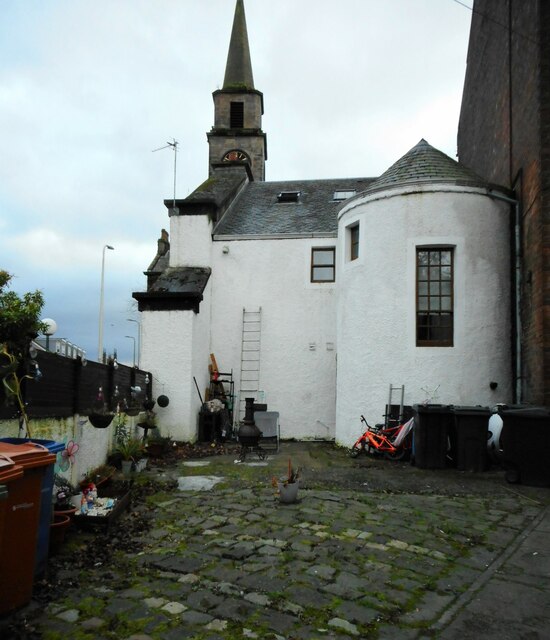
Image: © Richard Sutcliffe Taken: 16 Nov 2022
An 18th century Category C listed building http://portal.historicenvironment.scot/designation/LB36649. The semi-circular stair tower is a notable feature. The town steeple is visible behind.
Images are licensed for reuse under creativecommons.org/licenses/by-sa/2.0
Image Location


Leaflet Map data © OpenStreetMap
Latitude
55.941168
Longitude
-4.159636