Raised pavement, Chipping Campden
Introduction
The photograph on this page of Raised pavement, Chipping Campden by Derek Harper as part of the Geograph project.
The Geograph project started in 2005 with the aim of publishing, organising and preserving representative images for every square kilometre of Great Britain, Ireland and the Isle of Man.

There are currently over 7.5m images from over 14,400 individuals and you can help contribute to the project by visiting https://www.geograph.org.uk
Raised pavement, Chipping Campden
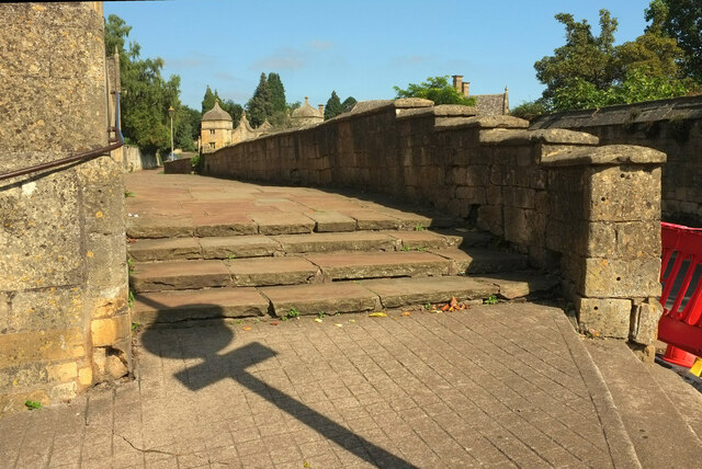
Image: © Derek Harper Taken: 15 Sep 2021
"Early C17, part of Sir Baptist Hick's layout, altered early C19. Low 3 ft ashlar wall fronting Campden Almshouses; angled capping, steps up at south end..." https://historicengland.org.uk/listing/the-list/list-entry/1305520?section=official-list-entry . The "Ogee ashlar domes" of the listed lodges https://historicengland.org.uk/listing/the-list/list-entry/1341979?section=official-list-entry to Old Campden Manor are visible along the road.
Images are licensed for reuse under creativecommons.org/licenses/by-sa/2.0
Image Location
Latitude
52.052058
Longitude
-1.777417