Old Boundary Marker on Cooper Lane, Clayton Heights
Introduction
The photograph on this page of Old Boundary Marker on Cooper Lane, Clayton Heights by N Hewlett as part of the Geograph project.
The Geograph project started in 2005 with the aim of publishing, organising and preserving representative images for every square kilometre of Great Britain, Ireland and the Isle of Man.

There are currently over 7.5m images from over 14,400 individuals and you can help contribute to the project by visiting https://www.geograph.org.uk
Old Boundary Marker on Cooper Lane, Clayton Heights
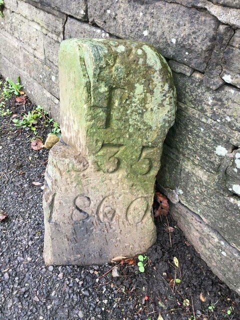
Image: © N Hewlett Taken: 16 Nov 2022
Municipal Boundary Marker against a stone wall on the B6147 Cooper Lane, Clayton Heights. On the boundary of North Bierley and Halifax Poor Law Unions. Inscribed N.B. (the B looks like I due to damage) / 183 (remainder lost due to damage) on one face and H. (the H looks like I due to damage) / (part lost due to damage) 35 / 1860 on the other. The top outer corner of the stone looks like it has been cut away. View also https://www.geograph.org.uk/photo/6475272. Milestone Society National ID: YW_BRAD02pb
Images are licensed for reuse under creativecommons.org/licenses/by-sa/2.0
Image Location
Latitude
53.770504
Longitude
-1.810603