Ford over River Ash, Much Hadham
Introduction
The photograph on this page of Ford over River Ash, Much Hadham by David Kemp as part of the Geograph project.
The Geograph project started in 2005 with the aim of publishing, organising and preserving representative images for every square kilometre of Great Britain, Ireland and the Isle of Man.

There are currently over 7.5m images from over 14,400 individuals and you can help contribute to the project by visiting https://www.geograph.org.uk
Ford over River Ash, Much Hadham
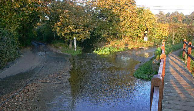
Image: © David Kemp Taken: 12 Nov 2022
Taken from Maltings Lane (foreground) and shows Oudle Lane (left) and Danesbridge Road (right).
Images are licensed for reuse under creativecommons.org/licenses/by-sa/2.0
Image Location
Latitude
51.84823
Longitude
0.074496