Tooting High Street
Introduction
The photograph on this page of Tooting High Street by Ian Capper as part of the Geograph project.
The Geograph project started in 2005 with the aim of publishing, organising and preserving representative images for every square kilometre of Great Britain, Ireland and the Isle of Man.

There are currently over 7.5m images from over 14,400 individuals and you can help contribute to the project by visiting https://www.geograph.org.uk
Tooting High Street
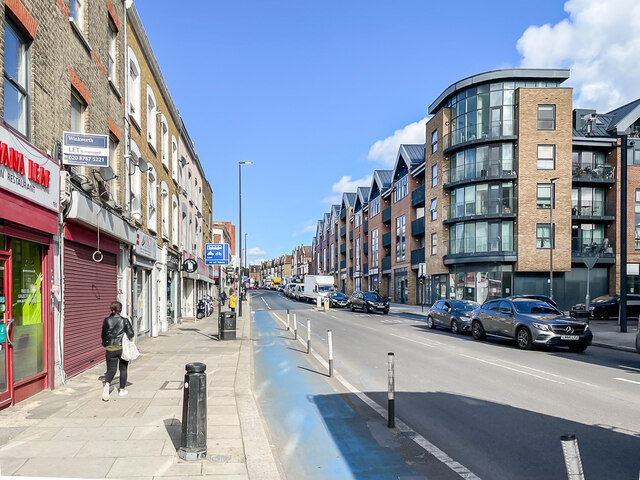
Image: © Ian Capper Taken: 7 Oct 2022
Looking along Tooting High Street with a late 19th Century parade of shops/flats on the left and a c.2010 redevelopment on the right. This section of Tooting High Street was named Merton Road on the 1897 25 inch map.
Images are licensed for reuse under creativecommons.org/licenses/by-sa/2.0
Image Location
Latitude
51.424246
Longitude
-0.171731