Old Milestone, B751, Crosshouse Road, Knockentiber
Introduction
The photograph on this page of Old Milestone, B751, Crosshouse Road, Knockentiber by Roger Griffith as part of the Geograph project.
The Geograph project started in 2005 with the aim of publishing, organising and preserving representative images for every square kilometre of Great Britain, Ireland and the Isle of Man.

There are currently over 7.5m images from over 14,400 individuals and you can help contribute to the project by visiting https://www.geograph.org.uk
Old Milestone, B751, Crosshouse Road, Knockentiber
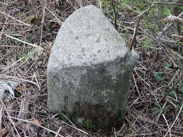
Image: © Roger Griffith Taken: 8 Nov 2022
Ayr granite by the B751, in parish of Kilmaurs (East Ayrshire District), opposite track to farm, at back of verge. On the 1895 map the mileage to Crosshouse was given as 1¼. The rivet benchmark represents 51.7 m ASL. The view showing the Kilmaurs face is Image Inscription reads:- Kilmaurs / 1 / Mile // Crosshouse / 1 / Mile Milestone Society National ID: AYE_CHKU02
Images are licensed for reuse under creativecommons.org/licenses/by-sa/2.0
Image Location
Latitude
55.626886
Longitude
-4.539293