
Habitancum Roman Fort
Introduction
The photograph on this page of Habitancum Roman Fort by Les Hull as part of the Geograph project.
The Geograph project started in 2005 with the aim of publishing, organising and preserving representative images for every square kilometre of Great Britain, Ireland and the Isle of Man.

There are currently over 7.5m images from over 14,400 individuals and you can help contribute to the project by visiting https://www.geograph.org.uk
Habitancum Roman Fort
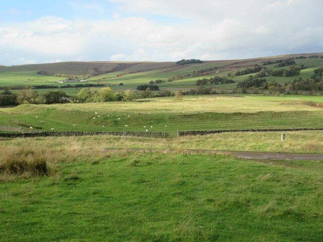
Image: © Les Hull Taken: 26 Oct 2022
Habitancum Roman fort, also known as Risingham, lies adjacent to Dere Street and close to the River Rede. It is a classic rectangular shape with rounded corners and is enclosed by a substantial rampart and wall. These measure up to 10m wide and stand up to 1.2m above the interior ground level. The standing remains were built in the early third century AD by the Emperor Severus and during excavations an inscribed stone was found bearing an inscription attesting to this. Three gateways were built as entrances to the fort and inside traces of many buildings can be seen surviving as earthworks. Some of these remains are probably from later re-occupation of the fort. A medieval settlement lies over the Roman remains and around the outside of the fort are fields of ridge and furrow cultivation. These mask a series of Roman ditches which would have added another layer of defence to the fort. Parts of the fort have been excavated on several occasions in the 19th and 20th centuries. This is a Scheduled Monument protected by law. https://keystothepast.info/search-records/results-of-search/results-of-search-2/site-details/?PRN=N7943
Images are licensed for reuse under creativecommons.org/licenses/by-sa/2.0
Image Location

Latitude
55.169897
Longitude
-2.172656