West Tanfield buildings [4]
Introduction
The photograph on this page of West Tanfield buildings [4] by Michael Dibb as part of the Geograph project.
The Geograph project started in 2005 with the aim of publishing, organising and preserving representative images for every square kilometre of Great Britain, Ireland and the Isle of Man.

There are currently over 7.5m images from over 14,400 individuals and you can help contribute to the project by visiting https://www.geograph.org.uk
West Tanfield buildings [4]
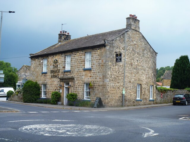
Image: © Michael Dibb Taken: 24 Jun 2022
The Bruce Arms Inn was built in the early 19th century. Constructed of rubble stone, squared and coursed to the front, under a stone slate roof. The central ashlar doorcase has pilasters, frieze and cornice. Listed, grade II, with details at: https://historicengland.org.uk/listing/the-list/list-entry/1190348 West Tanfield is a village in the Hambleton district of North Yorkshire, some 5½ miles northwest of Ripon. The village is sited on the north bank of the Rive Ure, astride the A6108 road from Ripon to Leyburn. The village name comes from the Anglo-Saxon 'tana feld', which mean "open land where young shoots grow" and is referred to in the Domesday Book. West Tanfield is home to the Marmion Tower, a 15th century gatehouse to the demolished manor house.
Images are licensed for reuse under creativecommons.org/licenses/by-sa/2.0
Image Location
Latitude
54.204868
Longitude
-1.589427