Disappeared railway track
Introduction
The photograph on this page of Disappeared railway track by AlastairG as part of the Geograph project.
The Geograph project started in 2005 with the aim of publishing, organising and preserving representative images for every square kilometre of Great Britain, Ireland and the Isle of Man.

There are currently over 7.5m images from over 14,400 individuals and you can help contribute to the project by visiting https://www.geograph.org.uk
Disappeared railway track
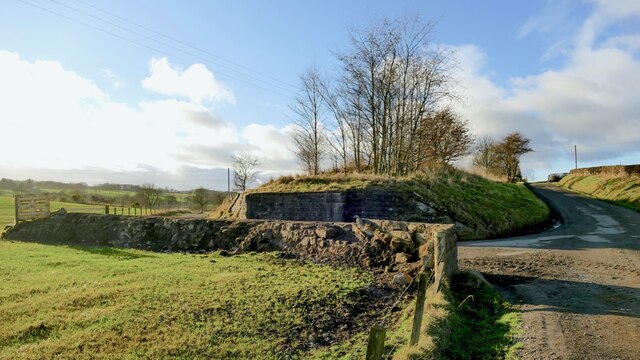
Image: © AlastairG Taken: 27 Jan 2022
Although the abutments and the embankment for the Avonbridge to Bathgate branch line are in place on the west side of the road, very little evidence remains on the east side. The embankment has vanished, possibly providing material for the farm track.
Images are licensed for reuse under creativecommons.org/licenses/by-sa/2.0
Image Location
Latitude
55.936859
Longitude
-3.713497