Stone Stile SX1073b
Introduction
The photograph on this page of Stone Stile SX1073b by Anne Green as part of the Geograph project.
The Geograph project started in 2005 with the aim of publishing, organising and preserving representative images for every square kilometre of Great Britain, Ireland and the Isle of Man.

There are currently over 7.5m images from over 14,400 individuals and you can help contribute to the project by visiting https://www.geograph.org.uk
Stone Stile SX1073b
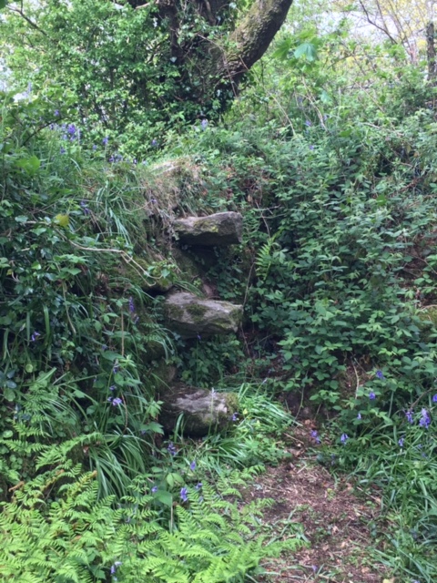
Image: © Anne Green Taken: 11 May 2021
Set back from the lane slightly west of Torr House. East Side: A sheep stile comprising three widely spaced steps set into the stone face of the hedge, leading up to flattish stones on top of the hedge, sufficiently wide to stand on. West Side: A cattle stile originally comprising six stone steps. However, a wooden stile has also been erected on this side, resting on the 5th stone step down, so now there are 4 steps down on one side of the wooden stile and one step on the far side. This stile is at the start of FP No. 503/4/1 (Gold) from Torr across the edge of three fields to the hamlet of Pendrift (north of Blisland).
Images are licensed for reuse under creativecommons.org/licenses/by-sa/2.0
Image Location


Leaflet Map data © OpenStreetMap
Latitude
50.533956
Longitude
-4.679405