Stone Stile SX1072a
Introduction
The photograph on this page of Stone Stile SX1072a by Anne Green as part of the Geograph project.
The Geograph project started in 2005 with the aim of publishing, organising and preserving representative images for every square kilometre of Great Britain, Ireland and the Isle of Man.

There are currently over 7.5m images from over 14,400 individuals and you can help contribute to the project by visiting https://www.geograph.org.uk
Stone Stile SX1072a
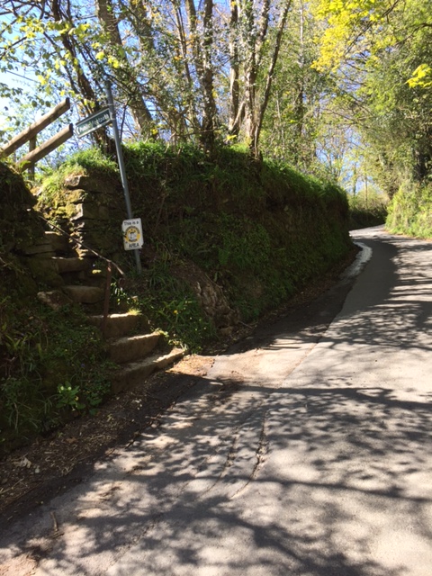
Image: © Anne Green Taken: 28 Apr 2021
Towards the bottom end of the lane from Waterloo up to Cassacawn Road. The stile gives access to fields and to St Pratt’s Cross, SE of Blisland. Seven stone steps on west side, slab top; one stone step and two bridging slabs on east side. Public footpath from Waterloo to St Pratts’ Cross Footpath. 503/17/1 (Silver). In conjunction with the stile at SX10385 73098 this is used as a short cut from Waterloo to Blisland village.
Images are licensed for reuse under creativecommons.org/licenses/by-sa/2.0
Image Location
Latitude
50.525809
Longitude
-4.672678