Stone Stile SX0973b
Introduction
The photograph on this page of Stone Stile SX0973b by Anne Green as part of the Geograph project.
The Geograph project started in 2005 with the aim of publishing, organising and preserving representative images for every square kilometre of Great Britain, Ireland and the Isle of Man.

There are currently over 7.5m images from over 14,400 individuals and you can help contribute to the project by visiting https://www.geograph.org.uk
Stone Stile SX0973b
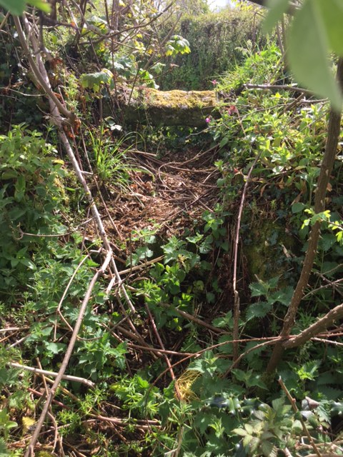
Image: © Anne Green Taken: 11 May 2021
On the narrow lane that leads downhill from Tregenna (north west of Blisland) to Tregaddick. Badly maintained, overgrown stile, which, at a guess, comprises three/four steps on both sides topped with another step on its side. This stile gives access into a field and is part of FP No. 593/1/1 (Bronze). However, at its far end, it goes through the grounds of a property called ‘Tremasden’ at Keybridge, where the path has become overgrown with bushes etc. and ends at the de Lank River, with no official access to the nearby lane. It has therefore become unused.
Images are licensed for reuse under creativecommons.org/licenses/by-sa/2.0
Image Location
Latitude
50.532778
Longitude
-4.69616