Ex Toll House, Manchester Road
Introduction
The photograph on this page of Ex Toll House, Manchester Road by Nigel Upton as part of the Geograph project.
The Geograph project started in 2005 with the aim of publishing, organising and preserving representative images for every square kilometre of Great Britain, Ireland and the Isle of Man.

There are currently over 7.5m images from over 14,400 individuals and you can help contribute to the project by visiting https://www.geograph.org.uk
Ex Toll House, Manchester Road
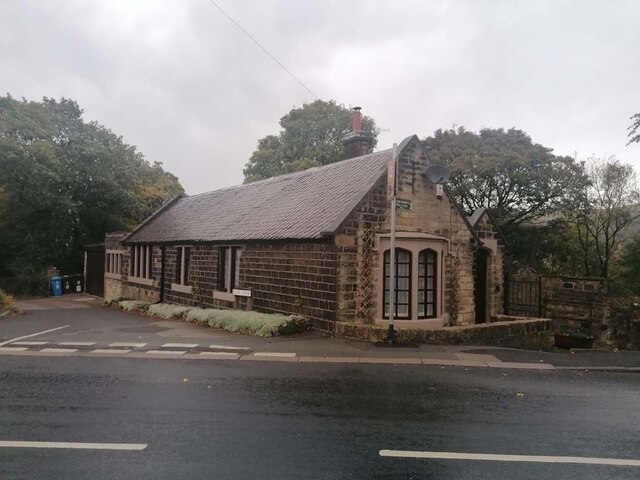
Image: © Nigel Upton Taken: 25 Oct 2022
Former Toll House originally servicing/erected by the Ridgehill, Lanes & Holehouse Turnpike Trust at the corner of Calf Lane where the Mossley borough boundary with Saddleworth crosses the main road (A635). The Image can be seen opposite. The Oldham Way long distance footpath also follows the boundary in this region. "Stalybridge, Hyde, Mossley & Dukinfield Tramways" terminus was at this location. Milestone Society National ID: MA.MOS01
Images are licensed for reuse under creativecommons.org/licenses/by-sa/2.0
Image Location
Latitude
53.529461
Longitude
-2.02695