Stone Stile SW7839a
Introduction
The photograph on this page of Stone Stile SW7839a by Carrie Langford as part of the Geograph project.
The Geograph project started in 2005 with the aim of publishing, organising and preserving representative images for every square kilometre of Great Britain, Ireland and the Isle of Man.

There are currently over 7.5m images from over 14,400 individuals and you can help contribute to the project by visiting https://www.geograph.org.uk
Stone Stile SW7839a
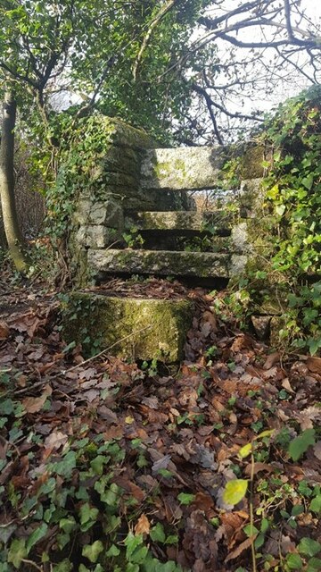
Image: © Carrie Langford Taken: 15 Sep 2021
This stile runs from the old A39, (known as Devoran turning) now a layby. At the side of it is a footpath, so it is easier not to use the stile. On the North side: 2 granite slabs. Width 36” Height 30” On the South side: Width 36” Height 48” 3 granite slabs & a large granite stone at the bottom. The footpath is not marked as a public Right of Way but is used extensively by walkers & dog walkers. The footpath runs out along the spit of land known as The Banks, or Butney Banks.
Images are licensed for reuse under creativecommons.org/licenses/by-sa/2.0
Image Location
Latitude
50.211876
Longitude
-5.099833