What was the A249...
Introduction
The photograph on this page of What was the A249... by Richard Dorrell as part of the Geograph project.
The Geograph project started in 2005 with the aim of publishing, organising and preserving representative images for every square kilometre of Great Britain, Ireland and the Isle of Man.

There are currently over 7.5m images from over 14,400 individuals and you can help contribute to the project by visiting https://www.geograph.org.uk
What was the A249...
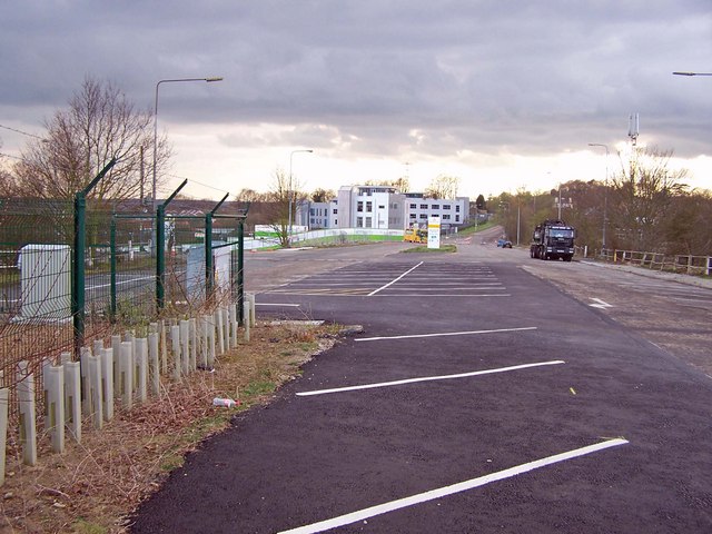
Image: © Richard Dorrell Taken: 19 Mar 2008
Fifteen years ago I would have been standing in the middle of a busy dual carriageway to take this photograph. Now, behind me, the road ends abruptly, with the new(ish) M20 causing the changes in road layout. The parking bays here are part of Maidstone's Sittingbourne Road Park and Ride car park. The enclosure to the left secures a telecommunications mast. The white buildings are new offices in Eclipse Park.
Images are licensed for reuse under creativecommons.org/licenses/by-sa/2.0
Image Location
Latitude
51.286252
Longitude
0.545149