Spinsters Rock
Introduction
The photograph on this page of Spinsters Rock by Mark Percy as part of the Geograph project.
The Geograph project started in 2005 with the aim of publishing, organising and preserving representative images for every square kilometre of Great Britain, Ireland and the Isle of Man.

There are currently over 7.5m images from over 14,400 individuals and you can help contribute to the project by visiting https://www.geograph.org.uk
Spinsters Rock
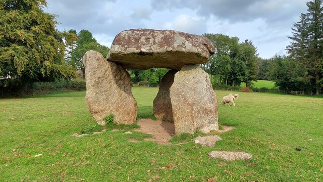
Image: © Mark Percy Taken: 25 Sep 2022
A Neolithic burial chamber dating back to 2500 - 3500 BC. Legend has it that it was built by three spinters one morning before breakfast. The chamber would have contained many graves and is thought to have been originally covered by a long earth mound. The stones were re-erected in 1862 after collapsing. The stones are accessible to the public all the time, with several parking spaces on the nearby lane.
Images are licensed for reuse under creativecommons.org/licenses/by-sa/2.0
Image Location
Latitude
50.702107
Longitude
-3.840989