Carboniferous Limestone
Introduction
The photograph on this page of Carboniferous Limestone by Jonathan Wilkins as part of the Geograph project.
The Geograph project started in 2005 with the aim of publishing, organising and preserving representative images for every square kilometre of Great Britain, Ireland and the Isle of Man.

There are currently over 7.5m images from over 14,400 individuals and you can help contribute to the project by visiting https://www.geograph.org.uk
Carboniferous Limestone
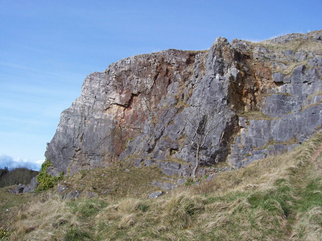
Image: © Jonathan Wilkins Taken: 19 Mar 2008
Great thicknesses of limestone of Carboniferous age (~350 million years) remain in the coastal hills in this area. Quarries on the south-facing slopes are no longer active, but serious extraction continues on the coast. The limestone is the result of accumulation of carbonate-rich muds from microscopic algae and shelly debris forming obvious fossils. Here the layers of the rock can be seen to dip steadily to the North.
Images are licensed for reuse under creativecommons.org/licenses/by-sa/2.0
Image Location


Leaflet Map data © OpenStreetMap
Latitude
53.280995
Longitude
-3.667798