Richmond buildings [30]
Introduction
The photograph on this page of Richmond buildings [30] by Michael Dibb as part of the Geograph project.
The Geograph project started in 2005 with the aim of publishing, organising and preserving representative images for every square kilometre of Great Britain, Ireland and the Isle of Man.

There are currently over 7.5m images from over 14,400 individuals and you can help contribute to the project by visiting https://www.geograph.org.uk
Richmond buildings [30]
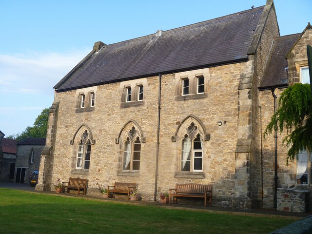
Image: © Michael Dibb Taken: 24 Jun 2022
This is the schoolroom at the rear of number 27 Victoria Road Image Built circa 1850 of coursed rubble stone with ashlar dressings under slate roofs. The schoolroom Image may have been the original church, which was converted into a schoolroom when the present church was built. Listed, grade II, with details at: https://historicengland.org.uk/listing/the-list/list-entry/1096920 Richmond is a picturesque market town in North Yorkshire, some 13 miles northwest of Northallerton and about 11½ miles southwest of Darlington. Set on the north bank of the River Swale, the town is on the edge of the Yorkshire Dales National Park, and is marketed as the Gateway to the Dales. Richmond was founded in 1071 and the castle was completed in 1086. Tourism is important to the local economy, as is the influence of the nearby Catterick Garrison army base. A traditional market operates every Saturday in the large cobbled marketplace.
Images are licensed for reuse under creativecommons.org/licenses/by-sa/2.0
Image Location
Latitude
54.404278
Longitude
-1.742551