Buntingford Market Place and High Street
Introduction
The photograph on this page of Buntingford Market Place and High Street by Malc McDonald as part of the Geograph project.
The Geograph project started in 2005 with the aim of publishing, organising and preserving representative images for every square kilometre of Great Britain, Ireland and the Isle of Man.

There are currently over 7.5m images from over 14,400 individuals and you can help contribute to the project by visiting https://www.geograph.org.uk
Buntingford Market Place and High Street
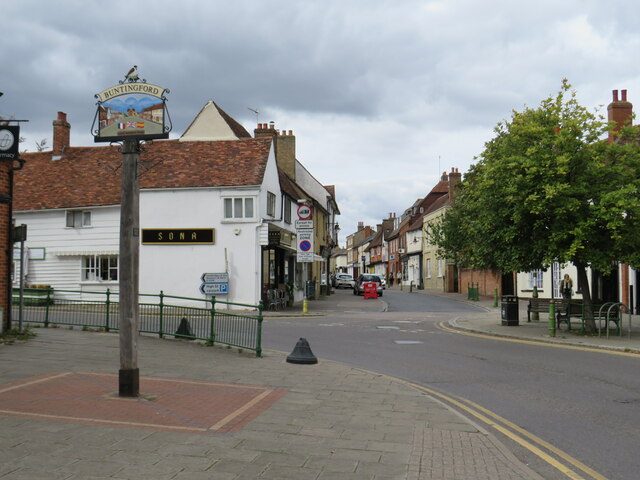
Image: © Malc McDonald Taken: 25 Sep 2022
This image was taken at the north end of Buntingford's Market Place, looking along the High Street. The high street lies on the route of Ermine Street, a Roman road. It formed part of the route of the A10 trunk road, until a by-pass was built to divert through traffic away from the town centre. A traditional town sign stands to the left of the image.
Images are licensed for reuse under creativecommons.org/licenses/by-sa/2.0
Image Location
Latitude
51.94669
Longitude
-0.019183