Stone Stile SW6544b
Introduction
The photograph on this page of Stone Stile SW6544b by Linda King as part of the Geograph project.
The Geograph project started in 2005 with the aim of publishing, organising and preserving representative images for every square kilometre of Great Britain, Ireland and the Isle of Man.

There are currently over 7.5m images from over 14,400 individuals and you can help contribute to the project by visiting https://www.geograph.org.uk
Stone Stile SW6544b
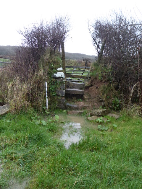
Image: © Linda King Taken: 29 Dec 2021
In the corner of a field, next to a gateway. A small cattle stile of granite with three steps on West side and two on the East side, including the top step each time. Wooden step over bar above the top step. This field corner gets very boggy in the winter, but it is next to a gateway (not shown) which seems to be permanently open. Public footpath 214/4/1 (gold) from B3301 near Carvannel Farm to Penpraze on Cott Road. The footpath runs along the boundary between Illogan and Portreath parishes but is in Illogan parish.
Images are licensed for reuse under creativecommons.org/licenses/by-sa/2.0
Image Location
Latitude
50.252659
Longitude
-5.293101