Sawmill Cottages (south-west range), Langley
Introduction
The photograph on this page of Sawmill Cottages (south-west range), Langley by Andrew Curtis as part of the Geograph project.
The Geograph project started in 2005 with the aim of publishing, organising and preserving representative images for every square kilometre of Great Britain, Ireland and the Isle of Man.

There are currently over 7.5m images from over 14,400 individuals and you can help contribute to the project by visiting https://www.geograph.org.uk
Sawmill Cottages (south-west range), Langley
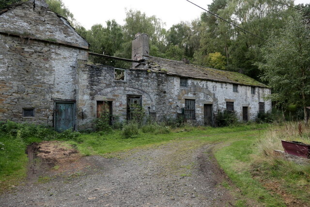
Image: © Andrew Curtis Taken: 15 Sep 2022
"The building range known as Sawmill Cottages, which includes a two storey house at the east end of a row of three cottages, is excluded from the scheduling, although the ground beneath it and the flue which exits the building through the south wall are included. The 1805 plan of Blagill Mill shows this range of buildings to be the reducing and refining house. Across the trackway to the west of the cottage conversions there is another range of buildings, mostly surviving as wall footings with the easternmost single storey lean-to building still roofed and used as a garage. This building range is considered to have comprised ancillary buildings (such as store-rooms and workshops) and will retain buried deposits that will allow the identification of their functions." https://historicengland.org.uk/listing/the-list/list-entry/1018211?section=official-list-entry Allen Valleys Local History Group have a photo of these buildings taken in 1905: http://www.allenvalleyslocalhistory.org.uk/photo/langley-1905-0025-014/ https://web.archive.org/web/20220917110225/http://www.allenvalleyslocalhistory.org.uk/photo/langley-1905-0025-014/
Images are licensed for reuse under creativecommons.org/licenses/by-sa/2.0
Image Location
Latitude
54.947858
Longitude
-2.267871