Remaining building of Langley & Blaghill Lead Smelt Mills
Introduction
The photograph on this page of Remaining building of Langley & Blaghill Lead Smelt Mills by Andrew Curtis as part of the Geograph project.
The Geograph project started in 2005 with the aim of publishing, organising and preserving representative images for every square kilometre of Great Britain, Ireland and the Isle of Man.

There are currently over 7.5m images from over 14,400 individuals and you can help contribute to the project by visiting https://www.geograph.org.uk
Remaining building of Langley & Blaghill Lead Smelt Mills
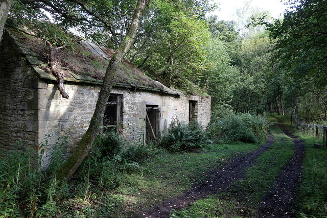
Image: © Andrew Curtis Taken: 15 Sep 2022
The two-storey rear elevation of this building is shown here Image "One nearly complete building survives at the east end of the area, 60m east of Sawmill Cottages, which has been interpreted as a coal and lime house dating to before 1805. This twin celled, two storey stone building built into the rising ground, retains some flooring and more than half of its stone slab roofing. Across the trackway behind this building there is the approximately 2m high earthwork dam for the reservoir (which still holds water). This reservoir was part of a complex water management system which supplied water to both mills." https://historicengland.org.uk/listing/the-list/list-entry/1018211?section=official-list-entry
Images are licensed for reuse under creativecommons.org/licenses/by-sa/2.0
Image Location
Latitude
54.94777
Longitude
-2.266778