Wayside Cross, Ripple
Introduction
The photograph on this page of Wayside Cross, Ripple by Mr Red as part of the Geograph project.
The Geograph project started in 2005 with the aim of publishing, organising and preserving representative images for every square kilometre of Great Britain, Ireland and the Isle of Man.

There are currently over 7.5m images from over 14,400 individuals and you can help contribute to the project by visiting https://www.geograph.org.uk
Wayside Cross, Ripple
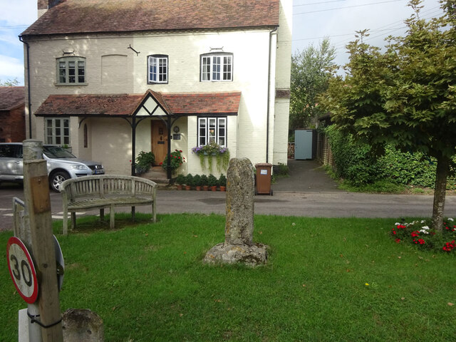
Image: © Mr Red Taken: 8 Sep 2022
On a triangle of grass at the road junction in the Uckinghall hamlet of Ripple village, Worcestershire. This view looks west to "Old Cross House". The road on the left is a dead end leading to the River Severn. The old shaft & base are contemporary, and medieval. There is another Wayside Cross in the village and a market cross in the churchyard. See images https://www.geograph.org.uk/article/Wayside-Crosses-Ripple-Worcestershire . A "Scheduled Monument" List No. 1014906 https://historicengland.org.uk/listing/the-list/list-entry/1014906 and a Grade II Listed Building No. 1302491 https://historicengland.org.uk/listing/the-list/list-entry/1302491. Milestone Society National ID: WOMH_RIP01
Images are licensed for reuse under creativecommons.org/licenses/by-sa/2.0
Image Location
Latitude
52.039755
Longitude
-2.193272