The Old Bank, 9-10 High Street, Abergavenny
Introduction
The photograph on this page of The Old Bank, 9-10 High Street, Abergavenny by Jo and Steve Turner as part of the Geograph project.
The Geograph project started in 2005 with the aim of publishing, organising and preserving representative images for every square kilometre of Great Britain, Ireland and the Isle of Man.

There are currently over 7.5m images from over 14,400 individuals and you can help contribute to the project by visiting https://www.geograph.org.uk
The Old Bank, 9-10 High Street, Abergavenny
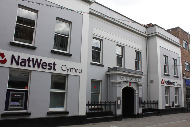
Image: © Jo and Steve Turner Taken: 25 Jul 2022
Grade II Listed bank with some possibly 17th century remains, it is made up of numerous stages of building and redevelopment. The house that was 10 High Street and was incorporated into no.9 as the bank, remained a residence (later the managers) until after 1937. Its current façade is probably as a result of an 1837 refurbishment. It is said to have been Hill, Hill, Osborne and Co. bank from 1822 when Abergavenny Bank moved to no.10 from 5 Nevill Street. (Known as Abergavenny Bank by 1810, it was the first bank in the town and started as a partnership of Thomas Hill, Samuel Hopkins & Lewis Osborne in 1792). It is unclear when 9 and 10 were amalgamated, map evidence is conflicting, but potentially it could be from at least 1800. This would fit with evidence that no.10 remained a private residence until c.1839 when Mr John Walter Roberts leased it to William Morgan for 99 years at £150pa. and Morgan leased the property to the bank. Bailey, Morgan, Greatrex and Williams opened the Monmouthshire Agricultural and Commercial Bank here in 1837 and are probably responsible for most of what you see from the street today. It became a part of the National Provincial Bank in 1868 and then in 1968 the bank announced its merger with Westminster Bank, but it continued to trade under its own name until vesting day of National Westminster Bank in 1970. Alex Robertson, Peter Francis and Partners were responsible for a major reconstruction in 1977-8 when stuccoed cornices, balustraded parapet, and other Victorian embellishments were removed.
Images are licensed for reuse under creativecommons.org/licenses/by-sa/2.0
Image Location
Latitude
51.822451
Longitude
-3.019062