Stone Stile SW5633b
Introduction
The photograph on this page of Stone Stile SW5633b by Linda King as part of the Geograph project.
The Geograph project started in 2005 with the aim of publishing, organising and preserving representative images for every square kilometre of Great Britain, Ireland and the Isle of Man.

There are currently over 7.5m images from over 14,400 individuals and you can help contribute to the project by visiting https://www.geograph.org.uk
Stone Stile SW5633b
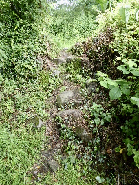
Image: © Linda King Taken: 28 Jun 2021
On Trannack Lane, about halfway between Trannack Farm and Trannack Mill. A path leads south from here across a narrow field, a stream with a clapper bridge then through woodland to the River Hayle. The small stile (18" - 24" high approx.) utilises steps of mixed stone variety, but at the time of reporting it is in very poor condition. Public footpath 111/21/1 gold Trannack to River Hayle.
Images are licensed for reuse under creativecommons.org/licenses/by-sa/2.0
Image Location
Latitude
50.146898
Longitude
-5.415129