The Cumbria Way, Greta Bridge
Introduction
The photograph on this page of The Cumbria Way, Greta Bridge by Adrian Taylor as part of the Geograph project.
The Geograph project started in 2005 with the aim of publishing, organising and preserving representative images for every square kilometre of Great Britain, Ireland and the Isle of Man.

There are currently over 7.5m images from over 14,400 individuals and you can help contribute to the project by visiting https://www.geograph.org.uk
The Cumbria Way, Greta Bridge
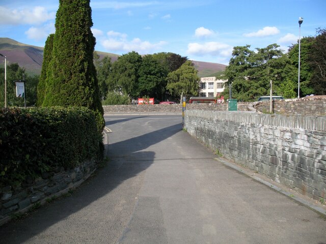
Image: © Adrian Taylor Taken: 19 Sep 2015
With the Derwent Pencil Museum in the background, The Cumbria Way approaches the A5271 road at High Hill beside Greta Bridge. Northbound walkers following The Cumbria Way turn right on the main road over the bridge (next photograph Image). The stone wall on the right is a part of Keswick’s flood defences. Behind the hedge to the left is the former Keswick School of Industrial Arts (photograph Image).
Images are licensed for reuse under creativecommons.org/licenses/by-sa/2.0
Image Location
Latitude
54.603882
Longitude
-3.142315