Holmes Mill, Greenacre Street
Introduction
The photograph on this page of Holmes Mill, Greenacre Street by Stephen Craven as part of the Geograph project.
The Geograph project started in 2005 with the aim of publishing, organising and preserving representative images for every square kilometre of Great Britain, Ireland and the Isle of Man.

There are currently over 7.5m images from over 14,400 individuals and you can help contribute to the project by visiting https://www.geograph.org.uk
Holmes Mill, Greenacre Street
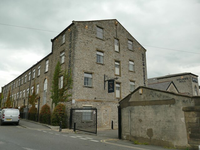
Image: © Stephen Craven Taken: 23 Aug 2022
The buildings further to the right, dating from the 1820s and 1830s, were a textile mill, but the one shown here, now called the Spinning Block, is labelled on the 1912 map as a 'technical school'. The whole site, now a business and leisure complex taking its name from the former mill, was listed Grade II in 2013 and the listing gives a detailed history https://historicengland.org.uk/listing/the-list/list-entry/1413649?section=official-listing .
Images are licensed for reuse under creativecommons.org/licenses/by-sa/2.0
Image Location
Latitude
53.867621
Longitude
-2.394738