Gate, piers and steps, Blackawton
Introduction
The photograph on this page of Gate, piers and steps, Blackawton by Derek Harper as part of the Geograph project.
The Geograph project started in 2005 with the aim of publishing, organising and preserving representative images for every square kilometre of Great Britain, Ireland and the Isle of Man.

There are currently over 7.5m images from over 14,400 individuals and you can help contribute to the project by visiting https://www.geograph.org.uk
Gate, piers and steps, Blackawton
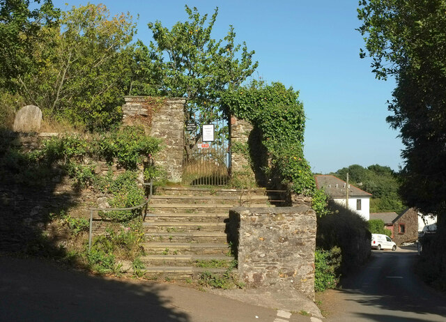
Image: © Derek Harper Taken: 30 Aug 2022
"Gate-piers, gate and steps to churchyard. Probably C18 ... The circa late C19 wrought iron gate has curved braced and spear- head shafts. the ground outside the churchyard is much lower and the gateway is reached by a broad flight of slate steps with flanking walls" https://historicengland.org.uk/listing/the-list/list-entry/1325140?section=official-list-entry . This is at the junction of School Lane and Park Lane (right).
Images are licensed for reuse under creativecommons.org/licenses/by-sa/2.0
Image Location


Leaflet Map data © OpenStreetMap
Latitude
50.34584
Longitude
-3.682123