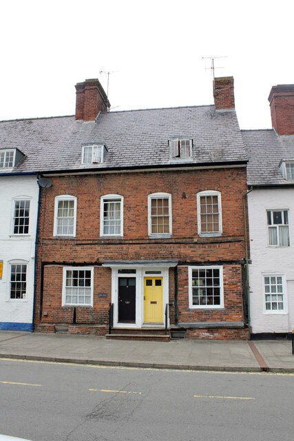
21 and 22 High Street, Welshpool
Introduction
The photograph on this page of 21 and 22 High Street, Welshpool by Jo and Steve Turner as part of the Geograph project.
The Geograph project started in 2005 with the aim of publishing, organising and preserving representative images for every square kilometre of Great Britain, Ireland and the Isle of Man.
There are currently over 7.5m images from over 14,400 individuals and you can help contribute to the project by visiting https://www.geograph.org.uk

Image: © Jo and Steve Turner Taken: 20 Jul 2022
Along with 20, 21 and 22 are a block of 3 Grade II Listed houses built as a single development by the Powis Estate about 1740. 21 & 22 incorporated earlier fabric. A desk-top study in 2002 by Clwyd Powys Archaeological Trust demonstrated that the High Street frontage was occupied by at least 1629. An excavation demonstrated evidence, with a small assemblage of medieval artefacts, that the plot may have been occupied during the 14th or 15th century, presumably forming part of a rear yard to properties fronting onto High Street. No.21, 5 floors from cellar to attic is a 1,644 sq ft 3 bedroom house. I assume 22 is a similar reflected plan.

