Old Boundary Marker on the A177 Stockton Road, Durham
Introduction
The photograph on this page of Old Boundary Marker on the A177 Stockton Road, Durham by Mike Rayner as part of the Geograph project.
The Geograph project started in 2005 with the aim of publishing, organising and preserving representative images for every square kilometre of Great Britain, Ireland and the Isle of Man.

There are currently over 7.5m images from over 14,400 individuals and you can help contribute to the project by visiting https://www.geograph.org.uk
Old Boundary Marker on the A177 Stockton Road, Durham
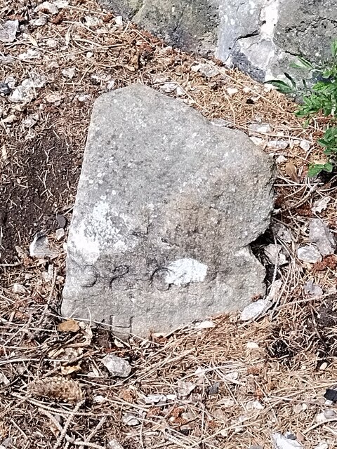
Image: © Mike Rayner Taken: 24 Aug 2022
Municipal Boundary Marker against a stone wall on the northeast side of the A177 Stockton Road just southeast of its junction with Whinney Hill. City of Durham parish. Inscribed D.U. (/ S.A) on its left face and D & C S (/ H B) on its right face. The stone marked the road maintenance responsibility boundary between the Durham Urban Sanitary Authority and the Durham and Chester-le-Street Highway Board, although the city boundary ran up the centre of the road here. Milestone Society National ID: DU_DUR09pb
Images are licensed for reuse under creativecommons.org/licenses/by-sa/2.0
Image Location
Latitude
54.76895
Longitude
-1.567435