Old guidestone
Introduction
The photograph on this page of Old guidestone by Chris Minto as part of the Geograph project.
The Geograph project started in 2005 with the aim of publishing, organising and preserving representative images for every square kilometre of Great Britain, Ireland and the Isle of Man.

There are currently over 7.5m images from over 14,400 individuals and you can help contribute to the project by visiting https://www.geograph.org.uk
Old guidestone
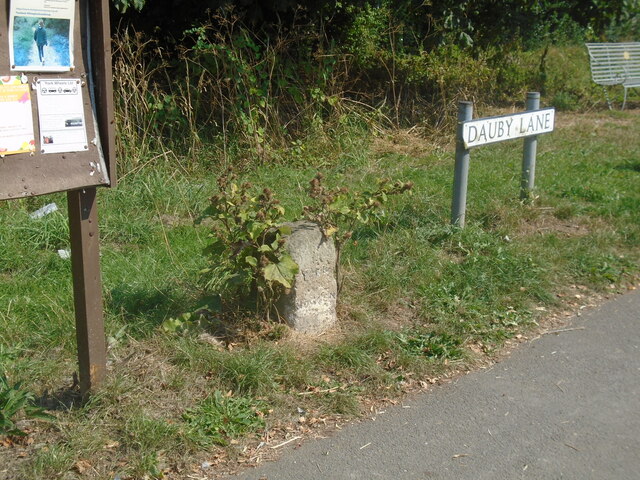
Image: © Chris Minto Taken: 14 Aug 2022
On the west side of the B1228 in Elvington where Dauby Lane leads off is this stone inscribed with YORK, which is to the left, north, and HOWDEN to the right, south. On each side face hidden by the burdock plants is KEXBY. Why is Kexby on both sides? The stone was painted white with black lettering in about 2008 Image but most of it has weathered away.
Images are licensed for reuse under creativecommons.org/licenses/by-sa/2.0
Image Location
Latitude
53.923545
Longitude
-0.940125